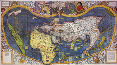
The Map That Guided Columbus
Wow! The first map below is very likely the one that Columbus used to chart his voyage to Asia.
And the second map shows Europeans what America looked like after the voyage of Columbus and Vespucci. It shows the existence of the Pacific Ocen for the first time.
Here's the story about the first map, the one Columbus probably used, from Wired Magazine. And here is a story about the second map, the one that was made after Columbus returned. It's from the Smithsonian Magazine.
the first map was made by Henricus Martellus, probably in 1491.


Comments
Post a Comment